mobile View, to the German Version tap the flag


- Republic of Equatorial Guinea
- präsidiale Republik
- own name: República de Guinea Ecuatorial
• Flags
• historical Flag
• Meaning/Origin of the Flag
• Coat of Arms
• Meaning/Origin of the Coat of Arms
• Aircraft Roundel
• Map
• Numbers and Facts
• History
• Origin of the Country's Name
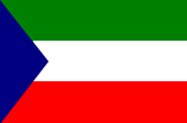
National flag,
ratio = 2:3,
Source, by: Corel Draw 4,
Wikipedia (D)


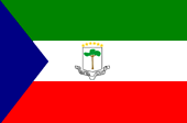
State and Naval flag,
Source, by: Corel Draw 4,
Wikipedia (D)


1973–1979,
National flag,
Source, by: Flags of the World
The flag of Equatorial Guinea shows three horizontal stripes in green, white and red, with an flat blue triangle in the leech. The state- and naval flag carrys further in the white centre-stripe the coat of arms of the state. The flag was introduced on 12th of October in 1968 on occasion of the independence from Spain. Blue stands for the ocean, green for the agriculture and the nature-treasures, white for the peace and red stands for the in the struggle for indpendence given blood.
Source: Die Welt der Flaggen,
Flaggen Wappen Hymnen
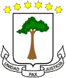
Coat of arms of Equatorial Guinea,
Source, by: Corel Draw 4,
Wikipedia (D)
In the arms is to see a mangrove-tree on a silver shield, over there are six golden six-jaged stars jag. By other sources should the tree allegedly be a mulberry tree, under which in the middle og the nineteenth century the Spanish and king Bonkoro of Bata came to their first agreement. The six stars above the shield symbolize the mainland and the five islands of the country. Beneath the shield the inscription: "Unity, Peace, Justice". Between 1973 and 1979, in the time of the rule of Macia Nguema, was used an other coat of arms.
Source: Die Welt der Flaggen,
Flaggen Wappen Hymnen
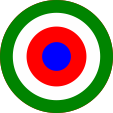
Aircraft Roundel,
Source, by: Wikipedia (EN)
Location:
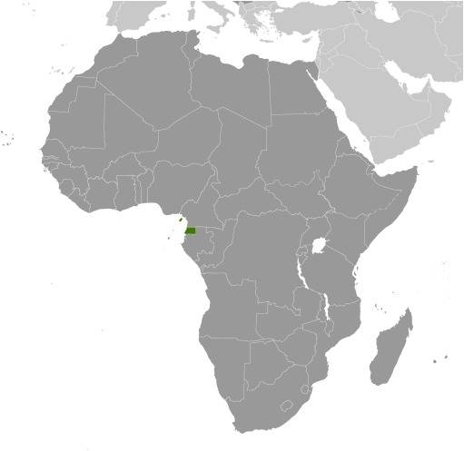
Source: CIA World Factbook
Map of the country:
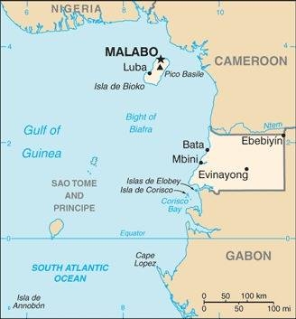
Source: CIA World Factbook
Area: 10.830 square miles, thereof Mainland Mbini (Rio Muni) ca. 10.038 sq.mi., Bioko Island 779 sq.mi., Annobón Island 7 sq.mi.
Inhabitants: 1.309.000 (2018)
Religions: 87% Roman Catholic, 5% Protestant
Density of Population: 121 inh./sq.mi.
Capital: Malabo (to 1973 Santa Isabel), 297.000 inh. (2018)
official Languages: Spanish, French and Portuguese
Currency: CFA-Franc (BEAC) = 100 Céntimes
Time Zone: GMT + 1 h
Source: Wikipedia (D)
1474 · conquest of the islands by Portugal
1778 · conquest of the islands by Spain
1843 · conquest of the mainland by Spain
29th of July 1968 · independence
Source: Atlas zur Geschichte,
Wikipedia (D)
The name "Guinea" described earlier the entire west coast of Africa between Cape Dakar and Cape Lopez. It goes back to the name "aguinaou", a word of the Tuareg, to describe peoples south of the Sahara: "Blacks".
Source: Handbuch der geographischen Namen
