
The Provinces of Prussia
Contents:
• Clickable Map of the Prussian Provinces, 1871 to 1920
• Clickable Map of the Prussian Provinces, 1922 to 1934
• The provinces of Prussia in alphabetical Order, from ca. 1850
Map of the Prussian Provinces 1871 to 1920
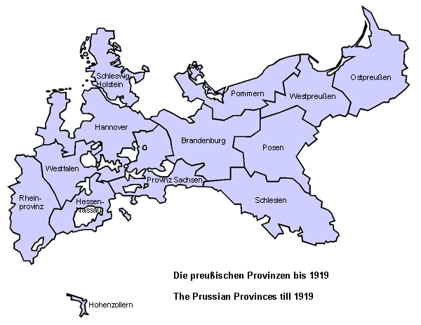
Source, Landkarte: Volker Preuß
Map of the Prussian Provinces 1922 to 1934
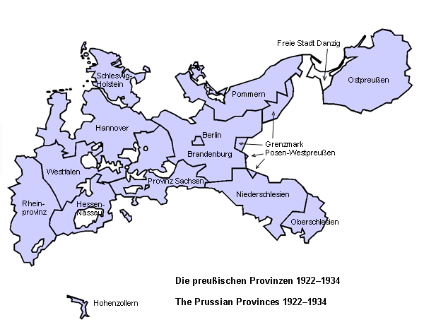
Source, Landkarte: Volker Preuß
The Provinces of Prussia in alphabetical Order (from ca. 1850)
• Town of Berlin
• Brandenburg
• Border Province of Posen West Prussia
• Hanover
• Hesse-Nassau
• East Prussia
• Pomerania
• Posen
• Province of Saxony
• Rhine Province
• Silesia
– Upper Silesia
– Lower Silesia
• Schleswig-Holstein
• Westfalia
• West Prussia
• Governmental District of Hohenzollern
![]()
![]()
![]()
