mobile View, to the German Version tap the flag


- Republic of Ivory Coast
- authoritarian presidial republic with multi-party-system
- own name: Côte d'Ivoire
• Flag
• Meaning/Origin of the Flag
• Coat of Arms
• Meaning/Origin of the Coat of Arms
• Aircraft Roundel
• Map
• Numbers and Facts
• History
• Origin of the Country's Name

National flag,
ratio = 2:3,
Source, by:
Flaggen und Wappen


The flag of the Ivory Coast was designed after the example of the french Tricolor and was officailly introduced on the 3rd of December in 1959. It shows three vertical stripes in orange, white and green. Orange stands for the north of the county (savannas), green for the south of the country and the coast (forests), and white stands for the unity between North and South. The flag has her roots in the PDCI, those political party, which leads the Ivory Coast into the independence. The colours, are given for the flag: orange = pt 151, green = pt 347.
Source:
Die Welt der Flaggen,
Flags of the World
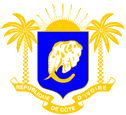
since 1964,
Coat of arms of Ivory Coast,
Source:
Wikipedia (D),
Prez001, CC BY-SA 3.0, via Wikimedia Commons
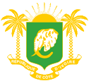
1960–1964,
Coat of arms of Ivory Coast,
Source:
Wikipedia (D),
Prez001, CC BY-SA 3.0, via Wikimedia Commons
The golden coat of arms shows since the 26th of June in 1964 a green shield with a silvery elephant head. The elephant is regarded as national animal, is here the largest occurring terrestrial animal, and the name of the country goes back to the tusks of the elephants. Above the shield appears a rising sun, it should symbolize a new beginning. On both sides of the shield is ever one palm tree standing on a banner with the name of the country. Before 1964 the shield was blazoned in blue, but it was changed to green, because this colour appears in the flag of the country.
Source:
Wikipedia (D)
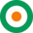
Aircraft Roundel,
Source, by: Wikipedia (EN)
Location:
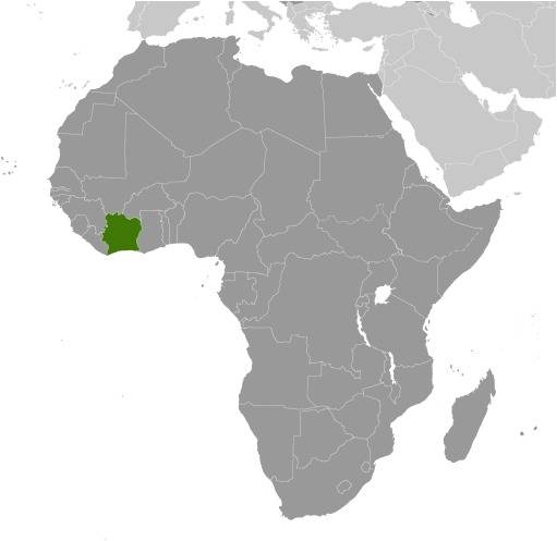
Source: CIA World Factbook
Map of the country:
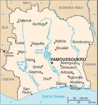
Source: CIA World Factbook
Area: 124.503 square miles
Inhabitants: 26.260.000 (2018)
Religions: 39% Muslim, 33% Christian, 12% Animist
Density of Population: 111 inh./sq.mi.
Capital since 1983: Yamoussoukro, 281.735 inh. (2014)
Capital to 1983: Abidjan, 4.395.243 inh. (2014)
official Language: French
other Languages: Diula, Kwa
Currency: CFA-Franc (BCEAO) = 100 Centimes
Time Zone: GMT
Source: Wikipedia (D)
1842 · beginning conquest by France
1893 · French colony
1904 · affiliation to French West Afrika
1958 · autonomous republic
7th of August 1960 · independence
1999–2008 · military coup d'état, civil war, division of the country, in the north rebels – in the south governmental troops
Source: Wikipedia (D)
The name Côte d'Ivoire, which is translated as 'Ivory Coast', goes back to the French Admiral Louis Edouard Bouet-Willaumez, he used this name for this region first time in 1839. The Government of Côte d'Ivoire has banned the translating of the country's name into other languages, so that in the official parlance 'Côte d'Ivoire' shall be used.
Source: Wikipedia (D)
