mobile View, to the German Version tap the flag


- Marquesas Islands, once even: Mendaña Islands
- possession of France
- part of the French possession of French Polynesia
- own name: Subdivision administrative des Îles Marquises
• Flags
• unofficial Flag
• Meaning/Origin of the Flag
• Map
• Numbers and Facts
• History
• Origin of the Country's Name

Flag of France,
ratio = 2:3,
Source, by: Corel Draw 4


since 1984,
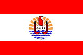
Flag of French Polynesia,
ratio = 2:3,
Source, by: Wikipedia (D)

since 1984,
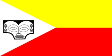
unofficial Flag,
Source, by: Wikipedia (D)

The Marquesas Islands – as a part of French Polynesia – have officially no own flag. It must be hoisted the French tricolor or additionally, the flag of French Polynesia. However, there exists for local purposes an unofficial flag.
This flag is unofficial and was created by Bishop Herve-Marie Le Cleac'h in the year 1984.
The flag shows two horizontal stripes in yellow and red and an isosceles white triangle at the leech. In the middle of the triangle the "Head of Tiki". White stands for peace, red stands for the feathers of the holy bird Kua. Yellow is an important local dye.
Source: Wikipedia (D),
FOTW
Location:
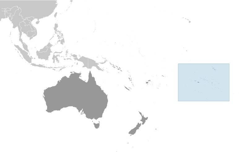
Source: CIA World Factbook
Map of French Polynesia:
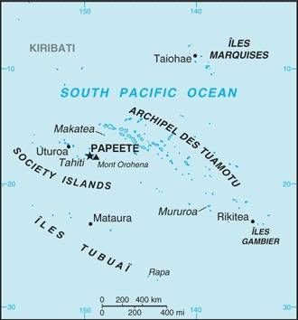
Source: CIA World Factbook
Map of the Islands:
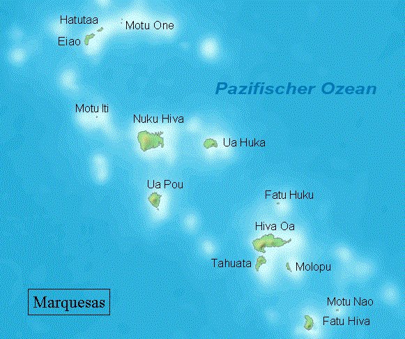
Landkarte/map, Source: By Demis (Own work, based on PD map from Demis)
[Public domain or Public domain], via Wikimedia Commons,
click to enlarge
Subdivisions of French Polynesia:

Landkarte/map, Source: By L. Claudel (Sardon - fr:Sardon)
[GFDL or CC BY-SA 3.0], via Wikimedia Commons,
click to enlarge
Area: 405 square miles
Inhabitants: 9.346 (2017)
Density of Population: 23 inh./sq.mi.
Main place: Taiohae (on Nuka Hiva), 2.183 inh. (2017)
official Language: French
other Languages: Marquesan (Polynesian dialect)
Currency: CFP-Franc (CFPF) = 100 Centimes,
CFPF = "Franc des Colonies Françaises du Pacifique"
Time Zone: GMT – 9:30 h
Source: Wikipedia (EN)
ca. 500 B.C. · beginning polynesian settlement
1595 · the Spanish seafarer Álvaro de Mendaña de Neira discoveres the archipelago and names it after Marques de Mendoza, the viceroy of Peru
1774 · the British seafarer James Cook travels through the archipelago
1791 · the US-american seafarer Joseph Ingraham discovers the northwestern group of the Marquesas
1792 · the British Lieutenant Richard Hergest of the SMS Daedalus mappes the Marquesas Islands
1804 · The Russian seafarer Adam Johann von Krusenstern travels through the archipelago and spends a few days on Nuku Hiva
1813 · the US-american Commodore David Porter anchors with the frigate USS Essex before Nuku Hiva, and takes the island for the United States in possession on 19th of November, and names it "Madison Iceland", but the US Congress did not ratify the seizure
1838 · the Frenchman Abel Aubert Dupetit-Thouars lands with Catholic missionaries on the islands
1838 · the French navigator Jules Dumont d'Urville travels through the archipelago
1842 · France declares the Marquesas Islands to a French Protectorate
1863 · severe pox epidemic
1903 · establishing of a unified French colonial administration for the Society Islands, Marquesas Islands, Tuamotu Islands, Gambier Islands and Austral Islands under the name "French Polynesia"
Source:
Wikipedia (D),
FOTW
As the Spaniard Alvaro de Mendaña de Neyra in 1595 discovered the archipelago during a trip from Peru to the Solomon Islands, he named the islands after Marques de Mendoza, the viceroy of Peru: "Las Islas Marquesas Don García Hurtado de Mendoza y Canete", from what arised the short version "Marquesas Islands". However, in the 18th/19th century the archipelago was also called after its discoverer: Mendaña Islands
Source:
Wikipedia (D)
