mobile View, to the German Version tap the flag
![]()


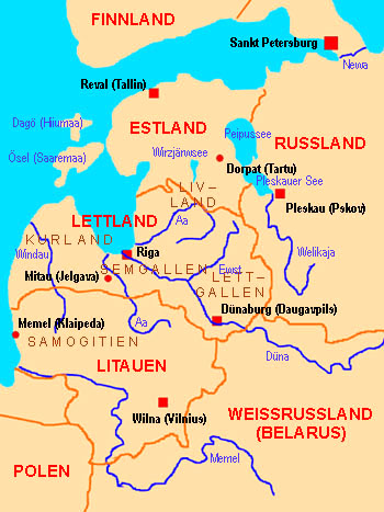
9th cent. · settlement by the Livonians
1202 · establishment of the "Order of the Sword Brothers" in Duenamuende
1230 · conquest of Courland, Livonia, Latgalia and Semigallia by the Order of the Sword Brothers
1236 · defeat of the Order of the Sword Brothers against the Lithuanians
1237 · unification of the Order of the Sword Brothers with the Teutonic Order, Courland, Livonia, Latgalia and Semigallia come as Livonian Federation with an own Master to the State of the Teutonic Order
1558–1595 · Livonian War, the Livonian Master of the Teutonic Order transforms Courland and Semigallia in a duchy as a Polish enfeoffment, Estonia was to cede to Sweden and partially to Denmark, Livonia and Latgalia came directly to Poland
1621 · Sweden conquers Livonia
1629 · Livonia comes officially to Sweden
1710 · Nordic War, Russia conquers Livonia
1721 · Peace of Nystad, Livonia and Estland come to Russia, Courland, Semigallia and Latgalia remain at Poland, Livonia becomes an own Russian gouvernement
1914–1918 · First World War: 1918 the German Empire conquers Livonia
7th of November 1917 · bolshevistic revolution in Russia, seizure of power by the Soviets
3rd of March 1918 · Soviet Russia capitulates towards the German Empire, Peace Treaty of Brest-Litovsk, development of the Baltic states, Livonia becomes separated between Estonia and Latvia
Source:
Atlas zur Geschichte,
Wikipedia (DE)
![]()
The name "Livonia" has its roots in the once mighty Baltic tribe of the "Livonians". The Livonians are nowadays nearly extincted. Livonia is named by the Latvians "Vidzeme" and by the Estonians "Liivimaa".
Source: Die Völker der Erde
![]()
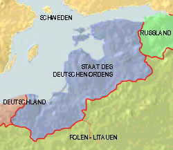 1410–1561
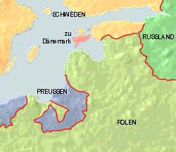 1561–1621
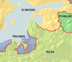 1621–1721
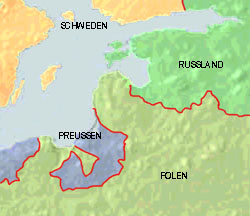 1721–1772
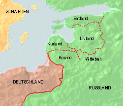 1815–1918
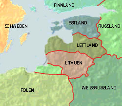 since 1991
