mobile View, to the German Version tap the flag


- Herm, with the neighbouring islands of Guernsey, Alderney, Sark, and Jethou constitutes the administrative bailiwick of Guernsey, an autonomous and by the British crown adminstrated territory
- one of the Channel Islands (Norman Islands)
• Flag
• Historical Flag
• Meaning/Origin of the Flag
• Coat of Arms
• Meaning/Origin of the Coat of Arms
• Maps
• Numbers and Facts
• History
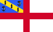
since 1953,
Flag of Herm,
ratio = 3:5,
Source, by:
Wikipedia (EN)


1950–1953,
Flag of Herm,
ratio = 1:2,
Source, by: Wikipedia (EN)
Herm Island applys the flag of England, the red St. George's cross on white background, with the escutcheon-flag of the island in the upper left staff corner. It is blue with a yellow diagonal stripe. The stripe contains three black silhouettes of monks which represent the missionaries St. Magloire, St. Sampson and St. Helier, who converted the population of the Norman Islands between the 6th and 9th century to Christianity. Each blue field shows a dolphin in it.
Source: Wikipedia (EN)
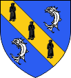
Coat of arms of Herm,
Source, by:
Wikipedia (EN), See page for author,
CC BY-SA 3.0, via Wikimedia Commons
The coat of arms is blue with a yellow diagonal stripe. The stripe contains three black silhouettes of monks which represent the missionaries St. Magloire, St. Sampson and St. Helier, who converted the population of the Norman Islands between the 6th and 9th century to Christianity. Each blue field shows a dolphin in it. The coat of arms and the flag have been created in 1953 by the British vexillologist William Crampton.
Source: Wikipedia (EN)
Location:
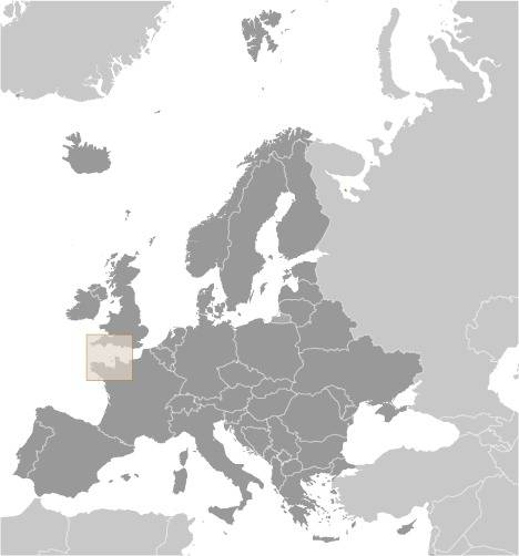
Source: CIA World Factbook
Map of the country:
Source: CIA World Factbook
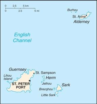
Map of the Channel Islands:
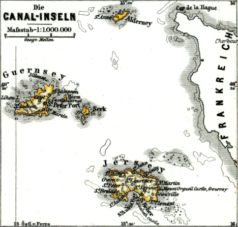
Source: Hand-Atlas für die Geschichte des Mittelalters und die neueren Zeit, von Spruner und Menke
Iin the north Alderney, in the south Jersey, in the west Guernsey, eastern of it Herm and Sark.
Area: 0,56 square miles
Inhabitants: 79 (2015)
Density of Population: 307 inh./sq.mi.
Capital: Manor House (Le Manoir)
official Languages: English, French
Currencies: 1 Guernsey Pound (£) = 100 Pence, 1 Pound Sterling (£) = 100 Pence
Time Zone: Greenwich Meantime = CET – 1 h
Source:
Wikipedia (EN)
ca. 600 B.C. · Celtic settlement
56 B.C. · to the Roman Empire
511 · to the Frankish Empire
843 · to the West Frankish Empire
880 · to the Kingdom of France
933 · to the Duchy of Normandy
1066 · William I. (Duke of the Normandy) gets crowned to the King of England, therewith come the Channel Islands nominally to the English crown
1106 · King Henry I. of England (son of William I.) occupies the Channel Islands, separates them therewith from the Duchy of Normandy, and binds them on England
1940–1945 · occupied by the German Empire
Translator of the English text: Joachim Nuthack
Source:
Atlas zur Geschichte,
Wikipedia (DE),
Discovery '97
